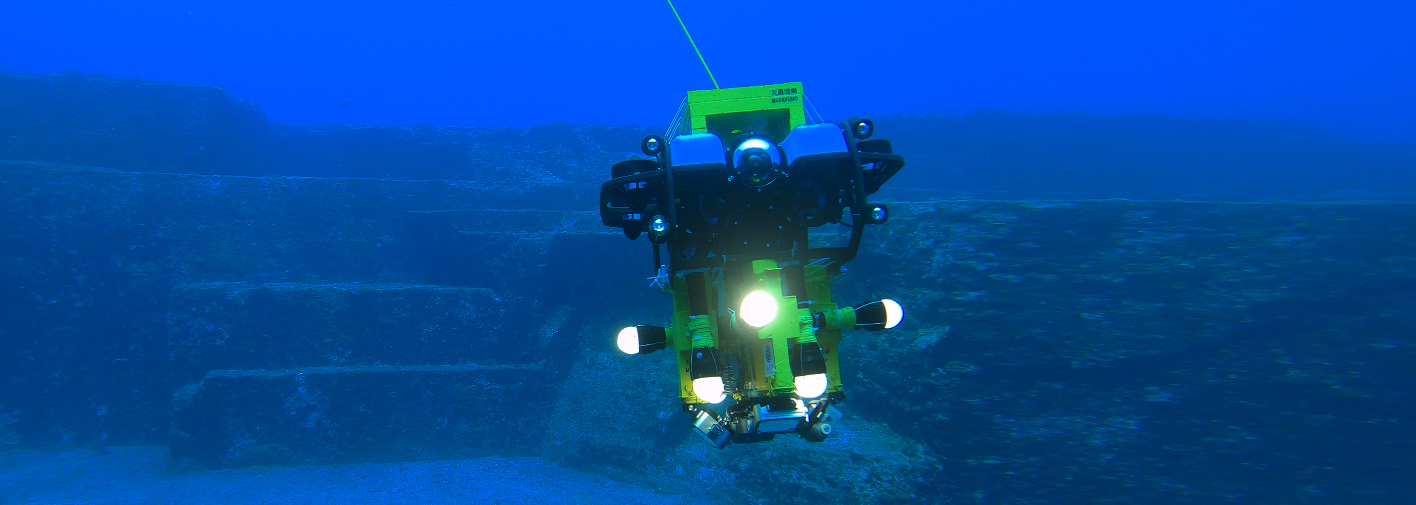
Underwater 3D Scanning RobotMURAKUMO
The photogrammetric 3D model created by W.S. P’s underwater 3D scanning robot, MURAKUMO, is so precise that it is possible to learn everything from the topography of the ocean floor to environmental information.
3D models can be created for areas ranging from several kilometers to several tens of kilometers.
The robot can be used for various industrial applications such as submarine cable surveys, shipwreck surveys, and pre-construction assessments for offshore wind farms.
MURAKUMO shows you where you cannot see.
World's Highest Level of Accuracy!
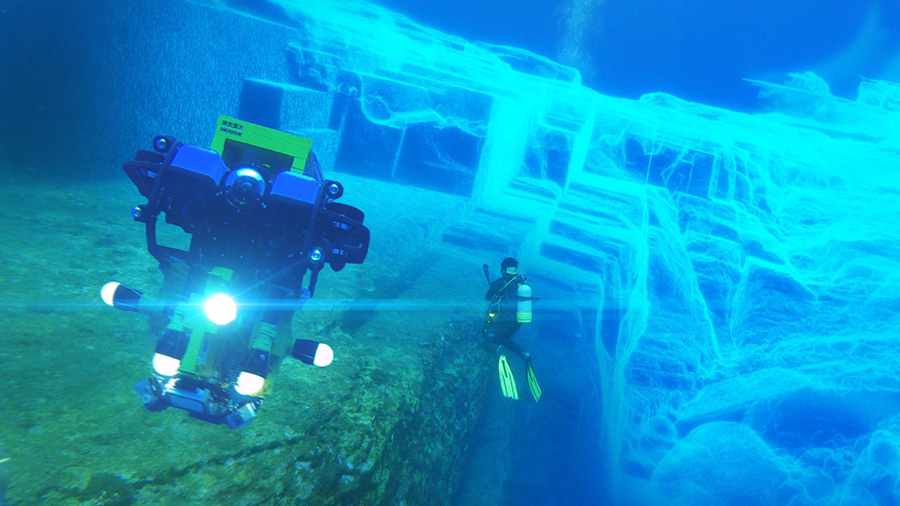
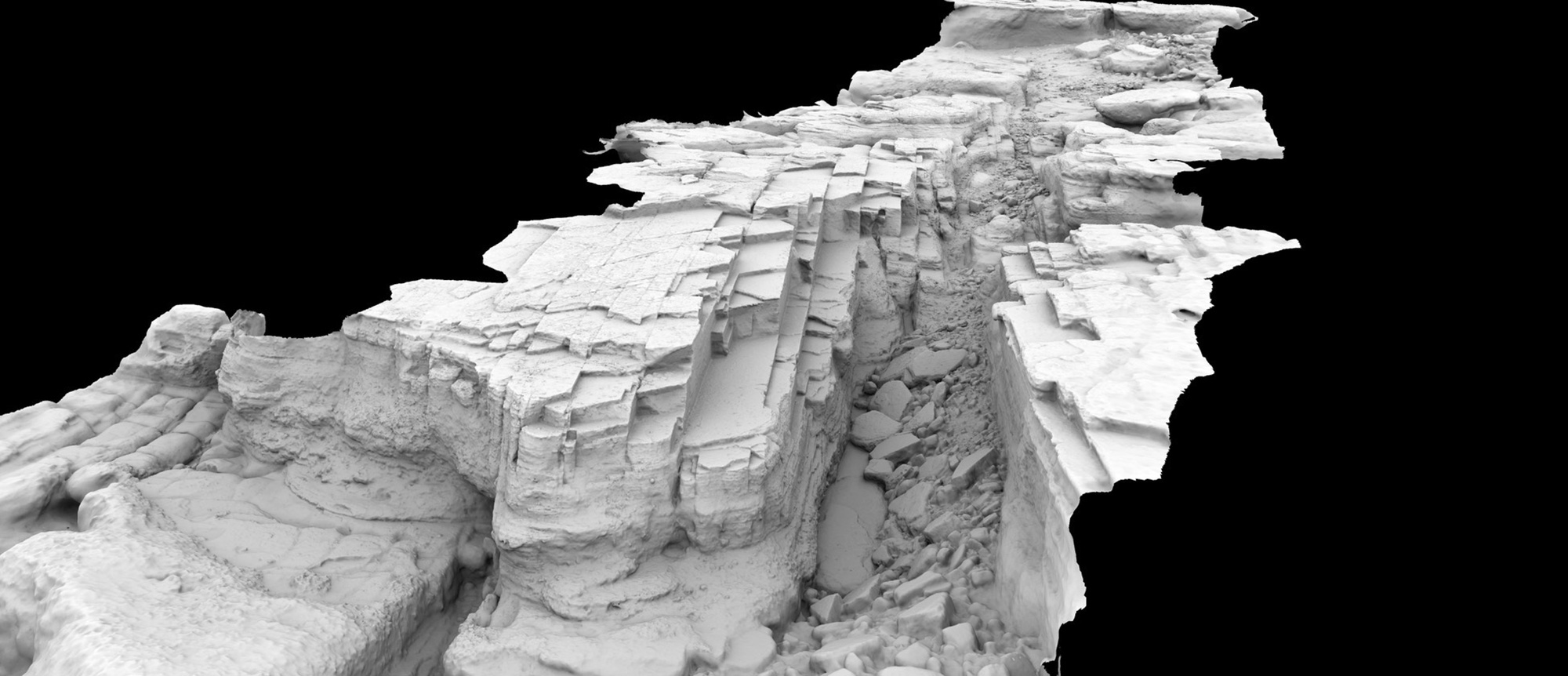
3D scanning of a sunken ship by underwater drone
In September 2020, we succeeded in creating a 3D model of the sunken ship Warabi using the underwater drone system Murakumo.By using MURAKUMO, we were able to create the world's first millimeter-accurate 3D model.
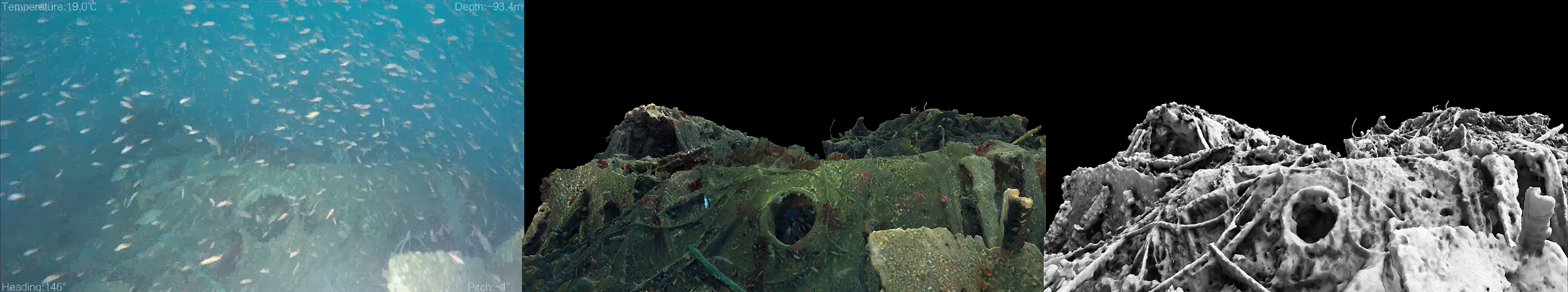
First Underwater Photograph of the Destroyer Warabi Discovered after 93 Years.
Our company was featured on TV Asahi's "News Station".Read More
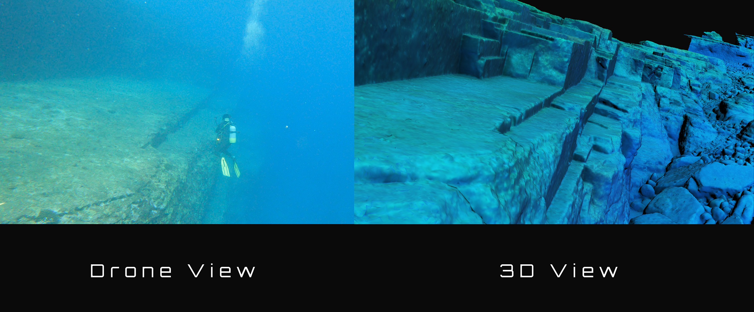
World's Largest! 3D scanning of seafloor topography.
The project was conducted in early April 2021 on a 60m x 300m seabed terrain near Shinkawabana, Yonaguni Town, Okinawa Prefecture.
The underwater drone system "MURAKUMO" was used to create the world's first 3D model of the seabed topography in Yonaguni, which is also a world-famous diving spot.
This is one of the world's largest 3D scans by an underwater drone.
A 3D scan allows you to see areas that are invisible due to transparency.
Seafloor 3D scanning service using MURAKUMO, the virtual street of the sea.
「Sea street®」
Please contact us for more information about our services.
Robot maintenance for submarine cable and offshore wind power.
In order to expand the use of renewable energy, W.S.P is working to promote the use of offshore wind farms.
The underwater 3D scanning robot MURAKUMO developed by W.S.P can be used to inspect wind power generation facilities and submarine cables, as well as to protect the marine environment.

Sea area spatial planning (conceptual example)
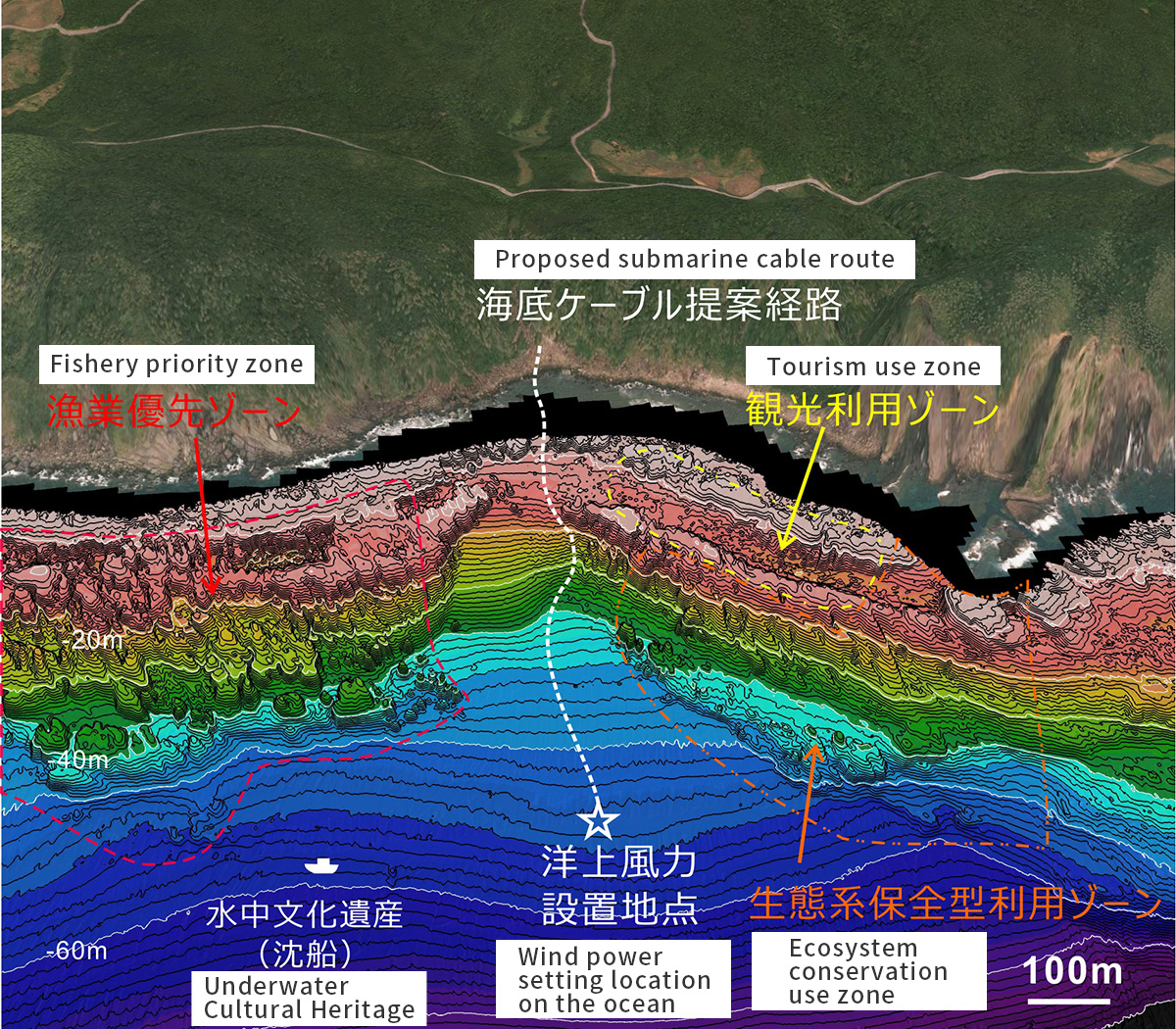 Source: Kyushu University (Research Center for Coastal Seafloor)
Conceptual example of an imaginary marine spatial plan overlaid on an actual seabed topographic map based on multi-beam bathymetry and a three-dimensional map of land.
The cable laying route is simulated based on detailed 3D scans using the MURAKUMO.The 3D scan can also be used for maintenance after the cable is laid.
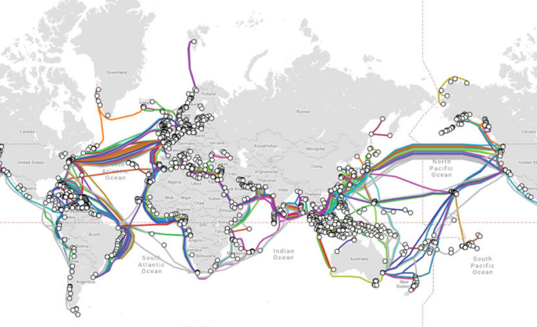
submarine cable
Source: TeleGeography「Submarine Cable Map」
3D Scanning
Seafloor 3D scanning service using MURAKUMO, the virtual street of the sea
「Sea street®」
Please contact us for more information about our services.